top of page

References | Smart Object Based 3D Data

3D Smart NEOM Project
PIF – Saudi Arabia
Satellite, Aerial, Terrestrial and Cadastral Mapping 3D city models were developed for urban areas of the Project (60,000 km2) using 18cm GSD aerial imagery
(2017-2018)

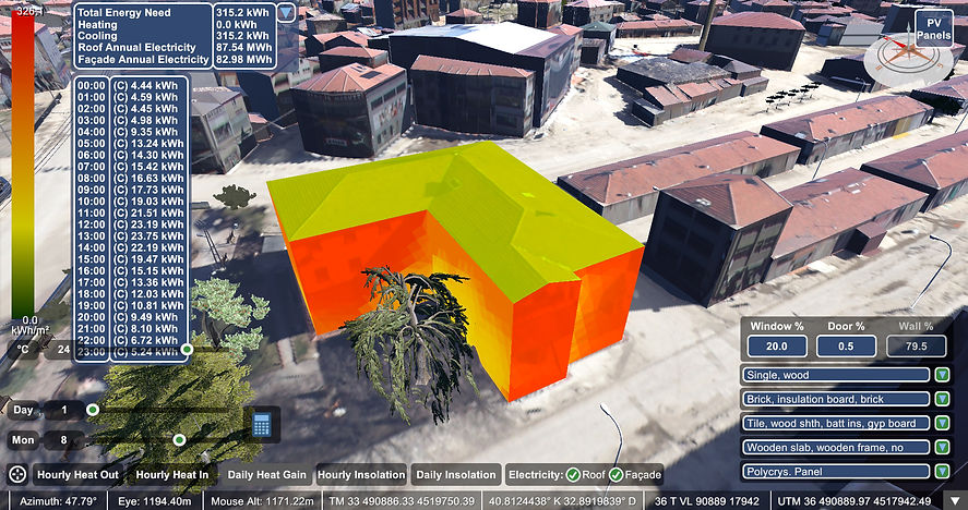
3D Smart City of Cerkes – Turkey
Geotech – Turkey
3D city models were developed for the city (27 km2) using 5cm GSD drone imagery
(2017)
Please reload
Smart 3D Applications & Analysis
Some examples are provided below.
bottom of page